Rating out of 5: 4
Source: walkhighlands as well as a book
Reasons:
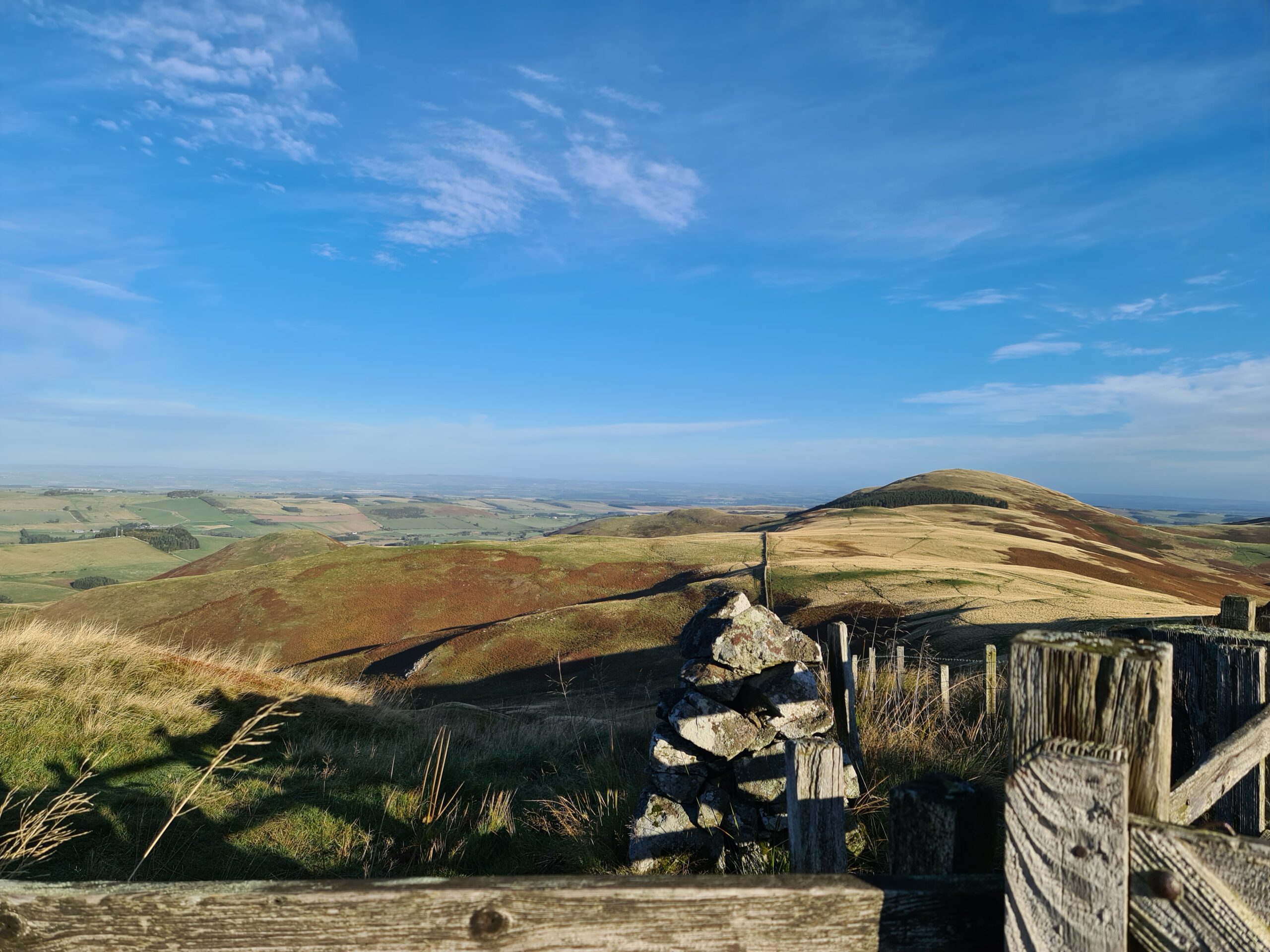
This lovely route is maybe one of the most distinct ones I have done till now. From a certain point on you won’t hear anything but the sounds of nature, you won’t see anything but nature surrounding you and maybe a ruin of an old farm, there won’t be many buildings you pass and the seclusion of the way makes it lovely if you want to get some peace.
However, the route is easily reached by bus from Kelso to Kirk Yetholm (which is also referred to as the Gateway to the Cheviots) which it really is. Not far from the Scottish-English Border Kirk Yetholm is nothing more but a small town nearly grown together with Town Yetholm.
The route itself is very lovely. I personally am not that big of a fan of England and so it went against my nature to cross the Border happily for the last part of the way up The Schil and on the top of The Schil I decided to take the more wild way down the Scottish side 😊 didn’t regret it, however if you do so you should be careful since there are no clear paths here (its basically just the other side of the fence so no difference really, depending on how much you like stepping on English soil it’s really not necessary). Surprisingly enough what I found on the way up was that the English side of the Border was way boggier than the Scottish one…. Make of that what you want.
On the way back from the Schil we decided against the lower version of the Pennin Way and instead decided to do a version of the way which I discovered in a book (you can find the name above)…. It most certainly was more challenging that way and my companion wasn’t too happy about the extra workout it took.
This alternative doesn’t take you back via the street (which I wouldn’t have liked anyway, since it would have been a very long stretch on the street) but up Latchly Hill down again, up Wildgoose Hill, down again and finally up Sunnyside Hill before descending on into Town Yetholm and following a path of your choice (or the street) back into Kirk Yetholm. The three above mentioned hills are all not very high, Sunnyside Hill having around 325m, however, after having done the whole way and walked up The Schil the hills did make for a good challenge… they are very steep to all sides up and down and so along with taking great care while descending it was also a mental challenge of some form to just get yourself to walk on and not just turn around and take some opportunity which might have taken us back to the street.
The reason why I preferred this alternative is as mentioned, we saved ourselves the long street stretch and if you take a map with you for the last stretch shortly before Town Yetholm, all the way to Kirk Yetholm you can get around walking on streets. Since the nearest bus stop to the beginning of the Walkhighlands route is Kirk Yetholm the book also shows you the way to this start.
The combining of the routes left us with a little over 19 km instead of the approx. 16km suggested by walkhighlands and by that the change made for an even bigger workout.
The reason why I only give 4 stars here (which still is very good) is that with the long road stretch I would have absolutely dreaded the last couple of kilometres and the change was a necessary one for me. Still I really enjoyed the walk (I would like to add that the Google Earth GPS data didn’t load on my phone… it does load for other routes so it must be something wrong here… however, I am still thankful for Walkhighlands description of the walk and the other map formats they provide added to my own paper map)
A solid 4 out of 5!
Pingback: Windy Gyle circuit, Cheviots – A scottish World
Pingback: Walking the St. Cuthbert’s Way (Scottish Part) – A scottish World